Explore the heritage sites of the Tour Down Under course
The Tour Down Under peloton will race through our streets of SA from Friday 17- 26 January, taking in beautiful scenery around Adelaide, Adelaide Hills, the Fleurieu Peninsula and the Barossa Valley.
But as well as the natural beauty of these regions, they have considerable historical significant.
In fact, 13 places of historical or heritage note are included throughout the men’s and women’s stages. Let’s get to know them…
Brighton Jetty
The original jetty was built by the Brighton Corporation in 1886 at a cost of £1650. Severe storms caused serious damage to the structure in 1928, 1948 and 1953 when portions were destroyed or washed away. After extensive storm damage in May 1994, the wooden jetty was replaced by a concrete one which opened in 1996.

Kitty Whyte shark victim memorial
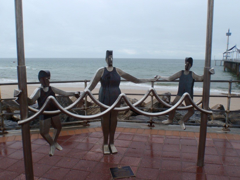
Next to the Brighton Jetty, sits a sculpture of Kathleen “Kitty” Whyte swimming with her 2 children. Nearby, there’s a stone fountain also bearing her name.
Both are memorials for “Kitty” who unwittingly made history by becoming South Australia’s first recorded death from a shark attack.
On 18 March 1926, Kitty, aged 35, had just finished teaching one of her regular swimming classes for local children at Brighton Jetty when she decided to take a dip herself. She was 30 metres from the jetty when she was bitten by a shark. She was taken to shore in a dinghy but unfortunately died from her injuries.

Old Noarlunga Township
On 30 April 1840 allotments at ‘Horseshoe Section, Noarlunga Township’ were offered for sale. Situated on land owned by the South Australian Company, the township was laid out along the lines of an English village with land reserved for a church, school, public markets and a cemetery. It was located on the Onkaparinga River, 3 miles from the mouth, at a place where the river could be crossed, but below which the river was still navigable.
By the end of the year, the town had a hotel, the Horseshoe, and a store. In March 1841, following success with locally-grown seed, grain and crops, the first market was held.
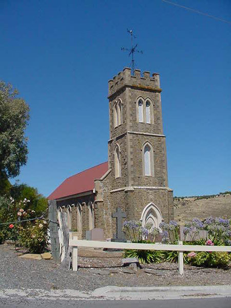
The very pretty St Philip & St James Anglican Church has been sitting on the top of the hill for 175 years – the foundation stone was laid in 1850!

Moana Beach
There is an anchor of the Nashwauk shipwreck on the shore of Moana Beach
On 13 May 1855 the 762 ton immigrant ship Nashwauk, only 18 months old, and carrying some 300 Irish girls, crashed ashore south of the mouth of the Onkaparinga at about 3:00 in the morning.
The passengers were able to be taken off the stricken ship and were cared for by local people. Luckily there were no casualties.
Port Willunga – Star of Greece shipwreck.
Loaded with over 16,000 bags of wheat destined for Great Britain, the Star of Greece was wrecked off a reef 200 metres from Port Willunga on Friday 13 July 1888. Of the crew of 28 men, 17 lost their lives. Survivors were taken to the Port Willunga Seaview Hotel for treatment and shelter.
A popular restaurant is named after the shipwreck, as well as memorials and commemorative plaques.
Port Willunga Pylons
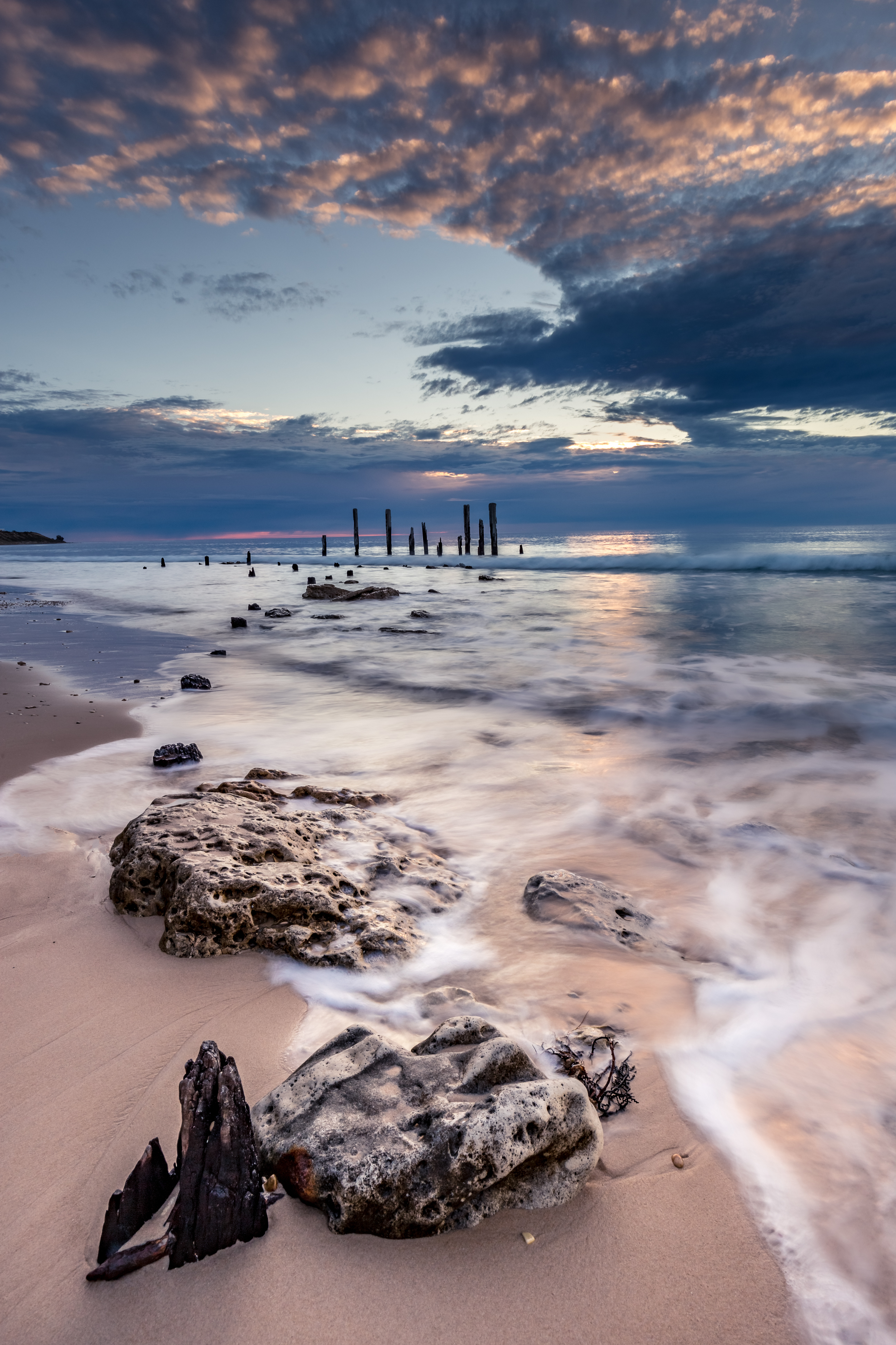
The pylons of the old Port Willunga Jetty are a much photographed attraction of all that remains of this 1850’s jetty.
The site is lies near the Maslin Bay to Aldinga Bay Coastal Cliff Section Geological Site. The strikingly coloured fossil-bearing rock strata revealed in the coastal cliffs at Maslin and Aldinga Bays provide excellent and rare exposures of the Tertiary sediments of the St Vincent Basin, ranging in age from Eocene (c. 50 million years) to Late Pliocene (c. 2 – 3 million years).
Port Willunga is known as Wirruwarrungga or Ruwarunga by the Traditional Owners, the Kaurna people, and is of significance as being the site of a freshwater spring said to be created by the tears of Tjilbruke, the creator being.

Two Norfolk Pines – Paddy and Charlie
Located at the base of the cliff and now at the entrance to the Kingston Park Caravan Park are 2 Norfolk Pine trees known as Paddy and Charlie. The story goes they were planted in 1850 by the 2 boys who lived in the grand house at the top of the hill. Their father, George Kingston, was an important figure in the convict colony of South Australia. The trees are now around 175years old!

The Tjilbruke Monument
The cyclists will go near where the Tjilbruke Monument is on Strickland Road at Kingston Park.
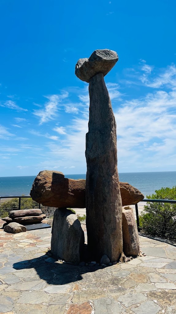
This marks an important story of the Kaurna Aboriginal people. The story tells of how Tjilbruke’s nephew was killed and, as Tjilbruke carried his body, 6 freshwater springs were created by his tears.
The monument was unveiled in 1972 at the top of the cliff.

Glenthorne National Park – eastern side
A 19th century farm was bought by the Australian army early in the 20th century and became an important horse breeding and training depot, sending thousands of horses to the Middle East and the western front in World War I.
In the 21st-century, it has become a new national park and includes a fantastic kids nature playground.
It is located on Majors Road, O’Halloran Hill – more information here.
Hallett Cove Conservation Park
Hallett Cove is a beach side suburb of Adelaide and is home to the Hallett Cove Conservation Park. On the beach and in the gully behind is an amazing outdoor geological museum.
The site is known throughout the scientific world because of the 19th century discoveries that revealed the Ice Age and Erratic boulders. The boulders are made of quartzite.
Why are they called “Erratic” boulders? Because they were moved from their original location near Victor Harbor by melting ice sheets around 280 million years ago. More information here.

The Onkaparinga River
The Onkaparinga River is 88km long and is the longest river in Adelaide! It travels south behind the ranges for a long way before it cuts through the sea in the spectacular Onkaparinga Gorge.
Large sections of the river are located in parks and include great walking and mountain bike trails.
The name Onkaparinga comes from the traditional name Ngankiparinga meaning “women’s river place”. Visit the Onkaparinga National Parks website here.
Myponga Reservoir
The Myponga Reservoir was completed in 1962 and provides about 5% of Adelaide’s water. The dam wall is 49 metres high.
In the last few years, the whole reserve has been opened for recreational use such as kayaking. More information about when to visit here.
Yankalilla Museum
Located at 163 Main South Road, Yankalilla, this could well be be the best rural museum in SA. A bone of the Diprotodon is on display at the museum — the largest marsupial ever known and was like a giant wombat. The museum is hoping to build a replica of this mega beast to stand outside the building, so please consider donating to the cause if you can get down to visit. More here.